What is a Transportation Master Plan? Why does Prince Edward County need it?
A Transportation Master Plan (TMP) sets a vision for transportation in the County. The process to develop a TMP starts with a review of the current transportation system, how it is working and where areas for improvement are needed. The TMP also reviews best practices and considers emerging trends to identify travel needs in the future. Ultimately, the TMP will identify a series of actions that the municipality can take to address walking, rolling and cycling, road, and other multi-modal transportation needs in the County. Specifically, the TMP looks to:
Ensure the transportation network is accessible for all ages and abilities to meet the future needs of Prince Edward County
Meet the goals and objectives of the County’s Community Development Strategic Plan and Official Plan
Improve road safety for all users
Consider linkages to the County’s Asset Management Plan
What is the process for the Transportation Master Plan?
The Transportation Master Plan will follow the Municipal Class Environmental Assessment master planning process and will be developed in three phases.
- Phase 1: Background review and baseline conditions analysis – will explore the existing conditions of the transportation system. What is working well, what needs to be improved, and what can we learn from others are questions the County will explore.
- Phase 2: Suggesting and Discussing Alternatives – will identify a series of options to continuously improve transportation systems in the County
- Phase 3: Finalizing the Approach and Creating an Implementation Plan - will reflect the final recommendations to advance transportation in Prince Edward County. At each stage in the process, the community will have opportunities to share their ideas, view and inputs to help shape the final Transportation Master Plan.
Does the Transportation Master Plan include transportation outside of Prince Edward County?
The Transportation Master Plan will focus primarily on improvements to the transportation system within the County boundary. There may be considerations made to advance transportation options across the region as appropriate.
Will the plan look at cycling and pedestrian issues and solutions or will it focus only on cars and transit?
The TMP will focus on the most effective ways to move people and goods within the County, following a complete streets approach. This will include looking at all forms of travel including walking, rolling and cycling.
How will my input be used?
In the early stages your ideas and inputs will be used to shape the overall understanding of the current issues and opportunities facing transportation in the County as well as help to form a vision for the Transportation Master Plan that reflects the desires of residents, visitors and other stakeholders. In later stages, your input will be used to inform potential refinements to the proposed policy directions and identify challenges, opportunities and considerations for the proposed policy directions prior to being included in the final Transportation Master Plan.
Has County Council been involved in the Transportation Master Plan Study?
To date, City Council has participated in the Transportation Master Plan process formally by completing a SWOT (Strengths, Weaknesses, Opportunities and Threats) Analysis of the County’s current Transportation system. Council will be updated through delegations to Council as the project advances, and all Councilors will be invited as stakeholders to community and stakeholder workshops.
This video is a recording of the Public Input Session held on August 27th, 2020 at 7:00 p.m.
This video is a recording of the Public Input Session held on November 25th, 2020 at 7:00 p.m.


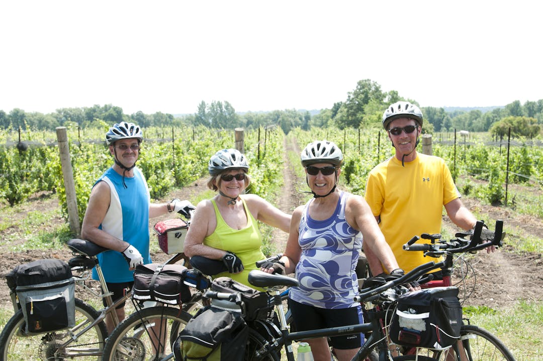
My wife and I have been living in the County for last 2 years, having moved here from Greater Toronto Area. We live in Rednersville area. I am retired. I love cycling and it's one of the reasons we chose to move here. As well, we love the peace, the slower pace and fine dining in the County. Like others, I say that we need more bike lanes or fixing current soft shoulders. Most County roads (outside villages) seems to be 80 kmh (which actually means 90-100 kmh). I find that most drivers are courteous and give me lots of room (actually they go into the oncoming lane as they pass me), but cars speeding by me does make me nervous. The bike lane created along County Rd 3 construction from Rednersville to Rossmore is fantastic and bikers, joggers and people just walking really appreciate it. We need more bike lanes like that - especially on Hwy 62 or 33. I agree with other contributors that the County has become a destination for tourists who are seeking quieter pace. You can't avoid visitors coming here when feature articles appear in the Globe and Mail, The Toronto Star and even New York Times telling folks about this beautiful island. It seems the region wants the business - as do the wineries and eateries - so we've got to make the County more bike friendly!
I frequently ride my bike in Picton and would like to see some places to lock a bike up.
Some bike racks would make it easier to enjoy Picton and all it has to offer
Speeding and traffic through the hamlet of CHERRY VALLEY is OUT of CONTROL. Residents are angry and frustrated. It is increasingly not safe for cycling, walking, or even getting in and out of your driveway. Traffic is noisy and dangerous, starting before 6 in the morning to late at night. Since covid speeding has increased with locals, as there is essentially no police presence. One idea would be to take the speed limit to 40km in the hamlets, but this would have to be enforced.
***Durham County recently adopted this strategy to control speeding. It works and doesn't require police. Please consider it!!!
https://www.durham.ca/en/living-here/automated-speed-enforcement.aspx
If Quinte Isle Campground moves ahead that is another 400 plus cars/trailers going through the town. A transportation study was done for Salmon Point and #18, but didn't address the IMPACT it would have on #10 in the hamlet of Cherry Valley. Two years ago I counted 240 cars in one half hour. That was TWO years ago. The quality of life of the tax paying residents of Cherry Valley is diminishing and seems not to be taken into consideration on any level.
Community spirit is at an all time low and people feel unsupported and frustrated. Please consider the Durham solution to stop speeding. It would be money well spent.
Fix the roads for cars first then consideration can be given to upgrading the roads for cycling.
We need paved shoulders for bicycles between Picton and Cherry Valley. I have seen one accident due to bicycles causing a rear end collision. Cyclists seem to think they own the road sometimes riding 2 and 3 abreast.
Just a small thing, but I'd like to see more of the new developments consider that customers may want to bike to shop and do business. For example the new Foodland plaza backs right on to the millennium trail, however to get to the plaza you have to cross the busy main Street bike down to the lights, and cross again to get over to the parking lot. It would have been so easy to make a small entry point off the trail into the parking lot. That would make it easier for people from Picton as well as Bloomfield to bike the trail to do some shopping
Why are we spending more tax payer money to build this for tourists?? There may be a few local residents and new tourist residents who use this but it is for the tourists, let’s be real. We need money spent on supporting residents who have lived and worked here for years. We need supports for our children to have something to do other than sit home while tourists over run our community all summer. We need low income housing NOW. We need a council who is looking out for residents rather than sinking more money to attract more tourists.
I am concerned that when a bike lane was established on my road it impacted turtle nesting. Several turtles were killed the the years following this project. Since turtles shut down an environmental wind energy project has turtle death been considered in this project. As well bikers here rarely keep to the path and continue to use the driving lanes. Will bikes be expected to be licensed as they formerly were in the town of Picton so that traffic issues can be reported?
I walked through the town hall corner from the fairgrounds to county co-working the other day and the speed of cars up Bridge to turn right is probably most dangerous aspect for pedestrians. The roundabout with pedestrian corridors works best for me, especially if the one crosswalk is aligned as close as possible with the front steps of Shire Hall.
Many Thanks to the whole team for their presentation of the draft recommendations on November 25th.
I am offering a few suggestions with respect to sharing the streets in the towns of Picton, Bloomfield and Wellington.
My reimagined streetscape for these towns would include a 40km speed limit on the Main Street and 30km on local streets that has been brought forward by others.
I would like to see the streets with painted markings in the following arrangement. Beside the sidewalk a two way bike lane with painted dash lines and the road bed here highlighted in a colour. Next to the bike lane a painted striped border of three to five feet to protect cyclists from car doors. Beside this protection border comes parking spots and two way traffic and finally parking for the other direction next to the sidewalk.
This street design is in operation in many cities around the world such as New York to great acclaim. It gives pedestrians, cyclists and drivers their own space for safety. The street is segregated using only paint so it will not interfere with the operation of emergency vehicles or snow plows. It is a low cost approach and suitable for testing trials. The car lanes only in town could be narrowed to accommodate the space needed for the bike lanes and provide cycling in both directions without the need to displace cyclists onto another route. Another positive feature of narrow lanes reported from other city studies are the traffic calming effect it has as drIvers slow down to navigate their way. The segregated spaces can give more security to all levels of cyclists in these towns. It can help promote and encourage more cycling tourism in combination with designated cycling shoulders on the bike routes around The County.
I would encourage more Share the Road signage for the benefit of cyclists and farmers. Increased signage to direct. cyclists on the various bike routes developed in The County would be welcome.
I have often thought about a different way for traffic at the town hill in Picton that would make that intersection accessible to all users and connect the town to Picton Bay and a future boardwalk and public spaces around the waterfront. Amongst the options presented last evening I liked the roundabout but in combination with the proposed north truck bypass. The centre of the roundabout could be designed with a smaller radius and with a low profile to enhance the turning ability for cars and small to medium sized trucks and ensure emergency vehicles can get through easily. Addressing the challenges with town hill would be a solution to make that intersection useable for everyone seamlessly connecting the whole town of Picton to its bay and to the lovely residential areas and out to the new hospital.
I look forward to hearing from others and the team as they digest all our comments and try to make them into workable solutions.
I was in attendance at your Nov 25th update. Several comments:
a) the 'blue' biking lanes that were determined to be 'ok' as they are, is true only because of the limited number of cars on certain roads, however a number of these roads are narrow due to the cracked condition at the road's edge. In addition a number of these roads are in poor shape (like Cty Rd 8 by Waupoos) and have no paved shoulders.
b) While Picton residents who cycle the Millenium Tr likely know, there are two access points to the M.T. from Picton. Upper Lake St, and the one by the LCBO (which is to be avoided, esp in summer due to the congestion of people coming into and out of town on Lake St). There should be a cross-walk at W. Mary & Lake to aid pedestrians and cyclist crossing there.
c) I applaud the idea of adding paved shoulders whenever streets are being repaved.
d) Cutting back the weeds on the MT needs to be done much earlier in the season. The weeds were so over grown this year that you literallly had to ride down the middle to avoid being wiped by the weeds, turning a two lane trail into a potentially dangerous one lane trail.
e) Cty Rds 11 & 12 to Sandbanks are so busy in the summer, that these should be priorities for getting paved shoulders/bike-walking designated spots.
f) Having people 'reserve' parking in Sandbanks will likely not deter people. They will park on the road shoulders outside the park and walk in. There almost needs to be a 'beach cam' so people coming can see how busy it is. Also, consider digital signs along the 401 at the Wooler, Hwy 64 and Hwy 49 intersections at the 401 so people can see ahead of time what the Sandbanks situation is ahead of driving the 45min to 1hr into the County to find it full.
g) You mentioned a 'north by-pass route' for trucks. Has a study been done to determine why these trucks are going through town in the first place. My guess would be that they were doing a delivery in town, so doing a 'by pass' will likely have a limited effect. Most people familiar with the County take that 'by-pass' now if they want to avoid d/town.
h) Ahhh, the Bridge Street Hill at Main St. A nightmare, especially with poor tourists who are confused when they come from Bridge St and are going up the hill. Has consideration been given to a set of three traffic lights/possibly four. The lights would be at the current stop signs on Main St., then one at the bottom of the Bridge St hill (possibly with one set at the intersection of Union and Bridge). The lights would have to be timed so that there is ample time to get up the hill. Having a light on Bridge at the intersection with Main would be a disaster for rolling back and especially sliding back on snow covered/icy winter roads.
i) Have you considered putting a walkway/ramp/set of stairs from Pineridge down to John St through the 'green space'. This would allow pedestrians an alternative to walking down Union which can be very busy. A side walk from Pineridge down to John on Union is a 'must'
I am looking forward to the next public engagement meeting in the meantime here are my thoughts. Please look at other municipalities regarding speed limits, Kingston and Belleville would be good comparators. Main Street in Picton, Wellington, Bloomfield should be 40 and "local" street should be 30. Many of the local streets are short and are not proportionate to support speed limit of 40 or more. Currently these streets are 50. Rather than work street by street use a blanket bylaw so we don't have to spend money on multiple signs. We cannot rely on common sense and we cannot rely on the OPP to enforce as their resources are limited. We would also need to implement traffic calming measures. It will only get worse as we continue to develop housing. If you look at letters sent to the Traffic Advisory Committee many of the letters are around speeding or perceived speeding The police can do nothing on the smaller streets. It is more of the quick acceleration and then braking that pedestrians and residents are dealing with.
There should be an extensive network of bikelanes throughout the county. Make this a green region where people come to to celebrate our beautiful nature here.
The County has a unique opportunity to promote itself as an alternative to cottage country and Niagara. To be successful, we need to continue to position ourselves as a place to slow down and enjoy the local wines, produce, art, environment, and general pace of life. Kayak, cycle, sail, etc. As others have said, slow traffic down, reduce speed limits, support cycling via signage and smooth and wide pavement on roads. Most county roads are currently hazardous to cyclists due to pavement conditions and hostile vehicle drivers who seem to believe that it’s their duty to literally run cyclists off the roads. We need to educate drivers to share the roads respectfully.
I agree wholeheartedly with Gerry Jenkisons' comments and would echo the positive note about the success of resurfacing the Millennium Trail which I pedal several times a year, especially the newly completed lowland section through Hillier. The addition of infrastructure such as the interpretive panels for wetland wildlife and the rest areas and innovative tool centre in Wellington. The economic benefits of this work are already paying off as entrepreneurs have used this corridor to rent bicycles and e-bikes and lead guided bicycle tours to the wineries. Without the smoothing, the trail would have been too precarious for the bachelorettes on bicycles after alcoholic drink tastings at 3 or 4 venues! I know some youth who were able to use the trail on motorcycle to get to their jobs. To promote recreational bicycling without revealing all of the "secret beaches" and dirt roads only us locals know, could Shire Hall provide me with information about which little lanes are public access? I do a lot of exploring on two wheels and leading my County Outings groups on foot "off-road" and often the entrance to a grassy lane (and even paved dead-end roads) have been posted "No Trespassing" by those who own the land adjacent to the road. Obviously the rural residents don't want city tourists flocking in, but if the road is public I should not be intimidated by signs trying to make it look private! For example, some offshoot lanes along Green Point Road, Morrison Point Road and Long Point Road. Rugged mountain biking isn't for everyone, but there have been biking clubs maintaining the trails and signs at Macaulay Mountain Conservation Area and there is great potential to attract this extreme sport community to the South Shore areas where ATV's and Jeeps run wild. I would challenge Harold's comment that highways were designed for automobiles; don't forget that roads were originally for horses and bicycles. Gentrification of The County has been going on for more years than we thought! Those who want the simple life are getting pushed out. Right now it might pay to watch the Montreal news as Maire Valérie Plante is taking heat for turning vehicle traffic away from commercial streets to allow pedestrians and bicycles a safe right-of-way. I say yay, build it and they will come! Cyclists are good people and bike paths are long overdue. Promoting bicycling should be part of a greater vision in preserving PEC's pastoral scenic back roads, not allowing them to build endless rows of houses, and to keep our air clean and reduce traffic noise. A tall order like that requires good leadership. This consultation is a good start. Thank you.
When is the next meeting planned for (can I be automatically be notified vis email).
I would love to see some "Share the Road" signs on all of the main County roads, especially near curves, where visibility is not good. Right now, some roads, such as CR 7, are being resurfaced but not the shoulders. This means that cyclists and motorists must share the road. Some roads are so bad that cyclists have to ride practically in the middle of the road. I’m thinking of the road in Waupoos, between the church and CR 13. I also think that it would be interesting for local newspapers and/or County Radio to write/talk more about cycling with the purpose of educating and entertaining both motorists and cyclists. Thank you for this opportunity.
I live in Cherry Valley and County Road 10 through our village is becoming like the 401 and it is becoming very dangerous to enter and exit my driveway. The speeding is out of control, and the traffic is ridiculous. Seldom is speeding enforced. I would like to see enforced 40km in all County towns. I think traffic should be highly considered when approving developments – specifically Quinte Isle – because the road through Cherry Valley is the main and quickest way to get there. As it's already super busy I can't imagine what 300+ more cars will feel like – for safety and for noise. CYCLING should be given high priority throughout the County – with a safe infrastructure in place – and marketing cyclists seems to a good fit for the County brand. On the Millennium Trail, I think ATV's spoil the opportunity for quiet contemplation and connecting to nature when walking. I think think the trail should be reserved for walking and cycling ONLY.
Pedestrian & bike traffic should be encouraged in historic villages. Traffic islands, antique lighting & interlocking brick with historical plaques would calm main streets. Picton to Sandbanks dedicated Bike lane similar to Millennium Trail would also encourage conservation & development.
Public transportation system should include meeting train service at all times at the Belleville station from main Street of Picton.